Trail On foot La Plagne-Tarentaise - Les Frasses - Photo

Tous les sentiers balisés d’Europe PRO

© OpenStreetMap contributors
Length
Length
5.7 km
Max alt
Max alt
1908 m
Uphill gradient
Uphill gradient
149 m
Km-Effort
Km-Effort  
7.8 km
Min alt
Min alt
1831 m
Downhill gradient
Downhill gradient
165 m
Boucle
Boucle
No
Signpost
Signpost
Creation date :
2022-02-15 17:27:20.829
Updated on :
2022-03-02 19:33:19.735

(0 Reviews)

On foot
On foot
1h45
Difficulty : Easy

Scan this QR Code to open this trail in the SityTrail application

FREE GPS app for hiking

Logo SityTrail SityTrail

IGN / Geographical institutes

Download SityTrail from the App Store Download SityTrail from Google Play

Logo SityTrail SityTrail World

The world is yours!

Download SityTrail from the App Store Download SityTrail from Google Play Download SityTrail on Huawei AppGallery

About

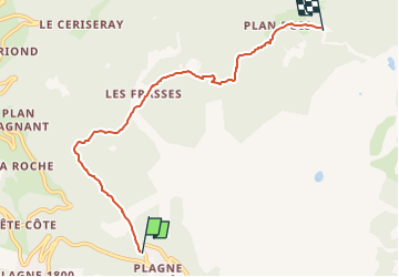
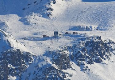
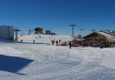
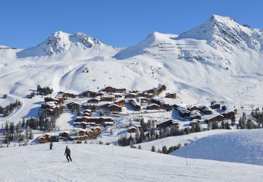
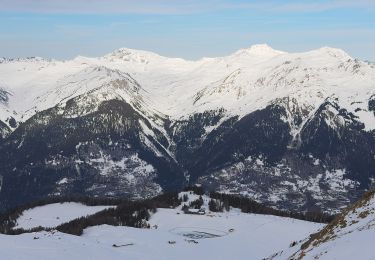
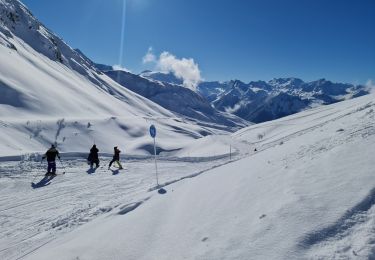
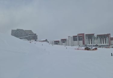
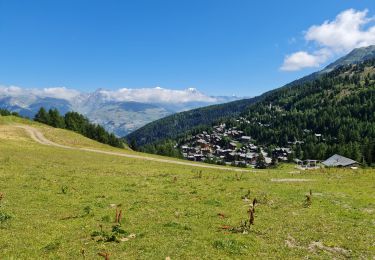
Trail On foot of 5.7 km to be discovered at Auvergne-Rhône-Alpes, Savoy, La Plagne-Tarentaise. This trail is proposed by SityTrail - itinéraires balisés pédestres.

Description

Trail created by Office de Tourisme de la Plagne.

Photos

Positioning

Country:
France
Region :
Auvergne-Rhône-Alpes
Department/Province :
Savoy
Municipality :
La Plagne-Tarentaise
Location:
Mâcot-la-Plagne
Start:(UTM)
319941 ; 5042745 (32T) N.

Trails nearby

Trail On foot Aime-la-Plagne - Le Mont Jovet - Photo
On foot
PRO

On foot

Medium
Aime-la-Plagne, Auvergne-Rhône-Alpes, Savoy, France
11.1 km | 21 km-effort
4h 45min
Yes
Trail On foot La Plagne-Tarentaise - Boucle du Carroley - Photo
On foot
PRO

On foot

Easy
La Plagne-Tarentaise, Auvergne-Rhône-Alpes, Savoy, France
4.2 km | 7.5 km-effort
1h 41min
No
Trail On foot La Plagne-Tarentaise - Sentier Découverte Grande Rochette - Photo
On foot
PRO

On foot

Easy
La Plagne-Tarentaise, Auvergne-Rhône-Alpes, Savoy, France
9.2 km | 16.3 km-effort
3h 42min
Yes
Trail On foot La Plagne-Tarentaise - Boucle de Roche de Mio - Photo
On foot
PRO

On foot

Easy
La Plagne-Tarentaise, Auvergne-Rhône-Alpes, Savoy, France
5.6 km | 12.1 km-effort
2h 44min
No
Trail On foot Aime-la-Plagne - Route Balcon - Photo
On foot
PRO

On foot

Easy
Aime-la-Plagne, Auvergne-Rhône-Alpes, Savoy, France
7.4 km | 9.6 km-effort
2h 11min
No
Trail On foot La Plagne-Tarentaise - Le Lac Vert - Photo
On foot
PRO

On foot

Easy
La Plagne-Tarentaise, Auvergne-Rhône-Alpes, Savoy, France
4.6 km | 7 km-effort
1h 36min
Yes
Trail Snowshoes La Plagne-Tarentaise - La Plagne Village, Col de la grande Forcle, Dou du Praz, La Bergerie, La Plagne Village. - Photo
Snowshoes
GUIDE
lhomme.ph

Snowshoes

Difficult
La Plagne-Tarentaise, Auvergne-Rhône-Alpes, Savoy, France
7.3 km | 10.8 km-effort
3h 56min
No
Trail Snowshoes La Plagne-Tarentaise - Plagne Village Aime 2000 par le chalet de Lovatière - Photo
Snowshoes
GUIDE
lhomme.ph

Snowshoes

Medium
La Plagne-Tarentaise, Auvergne-Rhône-Alpes, Savoy, France
3.6 km | 5.2 km-effort
2h 6min
No
Trail Walking La Plagne-Tarentaise - La Plagne Village Belle Plagne Bellecôte Plagne 1800 Plagne Centre  - Photo
Walking
GUIDE
lhomme.ph

Walking

Medium
La Plagne-Tarentaise, Auvergne-Rhône-Alpes, Savoy, France
9.2 km | 14.6 km-effort
4h 5min
No


Close
My subscriptions